
Flood risk in Iligan City is not something residents should treat as “only during typhoon season.” Iligan sits near rivers, coastal areas, upland catchments, and fast-draining mountain terrain, which means heavy rain can turn from inconvenience to emergency quickly.
This guide explains how to understand Iligan flood hazard maps, what the hazard colors mean, how to check if your home or business is in a flood-prone area, and which local offices and tools can help you prepare before the water rises.
For live local monitoring, residents may also check the GoIligan tools for Iligan weather updates and local risk awareness resources when planning travel, property checks, or emergency readiness.
Understanding Iligan City’s Flood Risk Geography
Iligan City’s flood risk is shaped by three big factors: rivers, terrain, and rainfall.
The city is located in Northern Mindanao and is a coastal highly urbanized city. It has urban lowland areas, river systems, and upland terrain that can send runoff quickly toward populated communities during heavy rain. The official city address listed by the Iligan City Government is Iligan City Hall, Buhanginan Hills, Pala-o, Iligan City, Philippines 9200.
The most remembered flood disaster in modern Iligan history is Tropical Storm Sendong, internationally known as Washi, in December 2011. A Typhoon Committee expert mission report recorded Iligan City as one of the hardest-hit areas, with Mandulog River mentioned in relation to downstream flooding impacts. The same report listed Iligan City with 490 identified deaths and 1,799 injured in the Sendong disaster table.
That history matters because Iligan’s flood risk is not only about rain falling inside the city proper. Flooding can also be influenced by upstream rainfall, river flow, drainage congestion, informal or formal settlement location, soil saturation, and structures built near waterways.
For local households and businesses, the practical lesson is simple: do not rely only on whether your street usually floods. Check your location against official hazard data, ask your barangay about known flood behavior, and pay attention to heavy rainfall advisories before water levels become dangerous.
Official Flood Hazard Maps and Risk Classifications
The most useful technical reference for Iligan flood risk is the official flood hazard mapping data from the UP DREAM / PHIL-LiDAR program and LiPAD Flood Modeling Component portal.
The LiPAD listing for City of Iligan, Lanao Del Norte 100 Year Flood Hazard Map describes a 10-meter resolution shapefile showing inundation extents if rainfall exceeds the 100-year rain return period. It explains that a 100-year return period flood has a 1% probability of occurring in a single year.
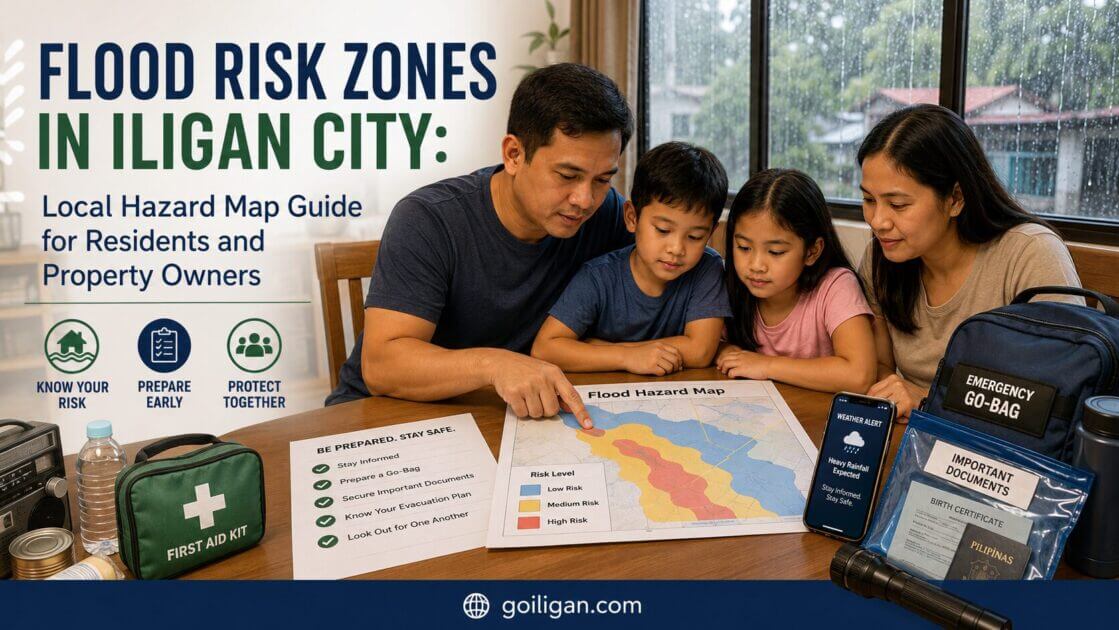
The same LiPAD page identifies three flood hazard levels:
| Hazard Level | Color on Map | Flood Depth |
|---|---|---|
| Low Hazard | Yellow | 0.1 m to 0.5 m |
| Medium Hazard | Orange | 0.5 m to 1.5 m |
| High Hazard | Red | Above 1.5 m |
The UP DREAM flood hazard map page also explains that flood inundation maps are based on five-year, 10-year, 25-year, 50-year, and 100-year rainfall scenarios.
For ordinary residents, these return periods can sound confusing. Here is the street-level explanation:
A 5-year flood map shows flooding that is statistically more frequent. If your area appears on a 5-year flood layer, treat it as a serious recurring risk.
A 25-year or 50-year flood map shows stronger rainfall scenarios. These are less frequent but can still happen within a lifetime.
A 100-year flood map does not mean flooding happens only once every 100 years. It means there is a 1% chance of that level of flood occurring in any given year, based on the model. Several “rare” flood events can still happen close together.
High-Risk Barangays and Critical Flood Zones
A publicly available complete barangay-by-barangay “high-risk list” for Iligan should be treated carefully unless it comes directly from CDRRMO, CPDO, MGB, LiPAD, HazardHunterPH, or another official map source.
What can be verified from official and technical sources is that Iligan’s flood mapping focuses strongly on river-related risk. The UP DREAM technical report for the Iligan River Basin states that the flood modeling work prepared static flood hazard and flow depth maps for 5-year, 25-year, and 100-year rain return scenarios.
The same report includes 100-year, 25-year, and 5-year flood hazard and flow depth maps for the Iligan River Basin.
Locally, residents should pay close attention to areas near:
Mandulog River and nearby floodplain areas
Mandulog is historically significant because of Sendong and because downstream communities can be affected by heavy upstream rainfall. Residents near riverbanks, bridges, low-lying sections, and former flood paths should check official hazard maps and barangay evacuation plans.
Tubod River and drainage-adjacent communities
Flooding around Tubod-linked routes and bridges has appeared in recent local reporting. MindaNews reported a November 2023 heavy rain event where flooding affected southern downtown Iligan and vehicles could not cross Tubod Bridge starting around 5 p.m., according to police information cited in the report.
Low-lying urban drainage zones
Urban flooding can happen even away from major rivers when drainage capacity is overwhelmed. These events may be short but dangerous, especially for vehicles, small shops, ground-floor homes, and students or workers commuting during afternoon storms.
Coastal and outfall areas
Floodwater eventually drains toward lower coastal areas and Iligan Bay. Residents near drainage outfalls, coastal roads, or low-elevation urban pockets should consider both rainfall flooding and drainage backflow during intense weather.
The safest way to treat barangay risk is not by label alone. A barangay may contain both safer elevated areas and flood-prone pockets. Your exact street, elevation, distance from waterways, and past flood experience matter.
How to Determine If Your Property Is in a Flood Zone
Here is a practical way to check your flood exposure before buying, renting, renovating, or building in Iligan.
Step 1: Find your exact location
Use your house, apartment, lot, store, or office address. If you are checking a property, save the nearest road, bridge, creek, river, school, chapel, or public landmark. Do not rely on barangay name only.
Step 2: Check official hazard map tools
Start with these public hazard sources:
Use the LiPAD 100-year Flood Hazard Map for Iligan to view official flood hazard layer information for the city.
Use the UP DREAM Flood Hazard Maps page to understand that maps may be available by different rainfall return periods, including 5-year, 10-year, 25-year, 50-year, and 100-year scenarios.
Use HazardHunterPH / GeoRiskPH for property-level hazard checking when available for your location. The HazardHunterPH map is a government hazard platform covering hazards such as flooding, landslide, earthquake-related, volcanic, and climate hazards.
Step 3: Compare the map with local experience
Maps are powerful, but residents should also ask neighbors and barangay officials:
Did water enter homes during Sendong or later floods?
How high did water reach?
Which road becomes impassable first?
Where is the nearest safe evacuation route?
Does the area flood from river overflow, poor drainage, or both?
Step 4: Confirm with local offices for serious decisions
For buying land, building, major renovation, or business site selection, ask for local verification from the relevant city office.
The Iligan City Government contact page lists the City Planning and Development Office (CPDO) with contact number 221-5388 and email cpdo@iligan.gov.ph.
The same page lists the City Disaster Risk Reduction and Management Office (CDRRMO) with contact number 221-8459 / 09177160826.
For construction-related questions, the city page lists the Office of the City Building Official (OCBO) with 09177151563 / 222-6384 and ocbo@iligan.gov.ph.
Flood Preparedness Strategies for Different Risk Zones
Flood preparedness should match your actual risk. A house in a red hazard area needs a different plan from a shop in a yellow hazard area.
If your property is in a high hazard zone
Treat flood planning as a household rule, not a seasonal reminder.
Keep emergency bags ready with medicine, IDs, power banks, flashlight, drinking water, basic food, cash, and copies of important documents. Move appliances, documents, and valuables above likely flood height. Avoid sleeping in ground-floor rooms during severe rainfall if water historically rises fast nearby.
Most importantly, know your evacuation trigger. Do not wait until water reaches the doorstep. If your barangay or CDRRMO advises preemptive evacuation, follow early.
If your property is in a medium hazard zone
Prepare for water entry, road closures, and power interruption. Raise outlets and important equipment where possible. Keep sandbags or flood barriers only as a first layer of defense, not as a reason to stay during dangerous flooding.
For small businesses, protect inventory and records. A sari-sari store, pharmacy, repair shop, or ground-floor office can lose more from soaked inventory than from structural damage.
If your property is in a low hazard zone
Low hazard does not mean “no risk.” Yellow areas may still experience ankle-deep to knee-deep flooding depending on rainfall, blocked canals, and nearby drainage. Keep drainage clear, monitor weather, and avoid parking vehicles in known low spots during heavy rain.
For renters and boarders
Ask the landlord or caretaker directly: “Did this building flood during Sendong or the last major rain?” Also ask where the evacuation route is and whether the room is on the ground floor. Students and workers living away from family should save CDRRMO, barangay, and trusted neighbor contacts.
For property buyers
Before paying reservation fees, check the hazard map, visit during or after heavy rain when safe, ask neighbors about flood history, and confirm with CPDO or the barangay. A beautiful lot can become a financial trap if flood exposure is ignored.
Government Initiatives and Flood Mitigation Work
Flood mitigation is usually a mix of drainage work, river management, land-use planning, community training, warning systems, and relocation or recovery support after disasters.
The Iligan City Government lists offices that are relevant to flood mitigation and response, including CDRRMO, CPDO, the City Engineer’s Office, CENRO, CSWD, and the Office of the City Building Official. The City Engineer’s Office is listed with 221-4645 / 09159859637 and ceo@iligan.gov.ph.
The city contact page also lists the City Environment & Natural Resources Office (CENRO) at 222-8211 / 09154633775 / cenro@iligan.gov.ph, which may be relevant for environmental and watershed-related concerns.
Residents should understand that flood control projects reduce risk but do not erase it. Drainage improvements can still be overwhelmed. Dredging can help flow but may not stop extreme events. Riverbank protection can fail when water exceeds design assumptions. That is why household-level planning remains important even when infrastructure improves.
Resources and Emergency Contacts for Flood Events
For emergency situations, use official and current channels first.
Iligan City Disaster Risk Reduction and Management Office
CDRRMO Iligan City
Phone: 221-8459 / 09177160826
Source: Iligan City Government contact page.
Facebook: Iligan City Disaster Risk Reduction & Management Office. The page identifies itself as the official page of ICDRRMO.
Iligan City Government
City Government of Iligan
Address: Iligan City Hall, Buhanginan Hills, Pala-o, Iligan City, Philippines 9200
Facebook: the official LGU Iligan page is publicly listed as City Government of Iligan.
National Emergency Hotline
For life-threatening emergencies, call 911. The Philippine emergency hotlines portal lists 911 as the National Emergency Hotline.
PAGASA and weather monitoring
PAGASA’s Mindanao regional forecast page publishes regional weather, rainfall advisories, thunderstorm advisories, and special forecasts.
For Iligan-specific checking, residents may also use weather.goiligan.com as a local weather reference and riskportal.goiligan.com for risk-related local awareness links.
Practical Flood Safety Tips for Iligan Residents
Before heavy rain
Charge phones and power banks. Move motorcycles and cars away from flood-prone roads. Keep medicines, IDs, cash, and clothes in a waterproof bag. Save emergency numbers on every family member’s phone.
During heavy rain
Do not cross flooded roads, especially near bridges, canals, and river-adjacent streets. Floodwater can hide open manholes, strong currents, debris, and electrical hazards. If local authorities announce evacuation, leave early.
After flooding
Avoid returning home until authorities say it is safe. Watch for damaged electrical wiring, unstable walls, contaminated water, and sharp debris. Take photos of damage before cleaning if you need documentation for assistance, insurance, or landlord reporting.
Conclusion: Use the Map, Then Make a Plan
Flood maps are not meant to scare residents. They are tools for better decisions.
For Iligan households, renters, property buyers, and business owners, the smartest next step is to check your exact location against official hazard maps, ask your barangay about real flood history, monitor weather before heavy rain, and prepare an evacuation plan before you need it.
A flood-safe Iligan starts with small, practical decisions: knowing your risk zone, keeping documents dry, saving emergency contacts, and leaving early when warnings are issued.


Recent Hot Topics
How to Hire an Accountant in Iligan City: Complete Local Guide for Businesses, Freelancers, and Professionals
Best Accounting Firms in Iligan City: Local Guide for Businesses, Freelancers, and Professionals
Iligan’s Startup Future Begins Here: Startup Iligan Summit ’26 Calls on Builders and Changemakers